Stuck in Traffic on Old San Jose Road... What If We Had to Evacuate?
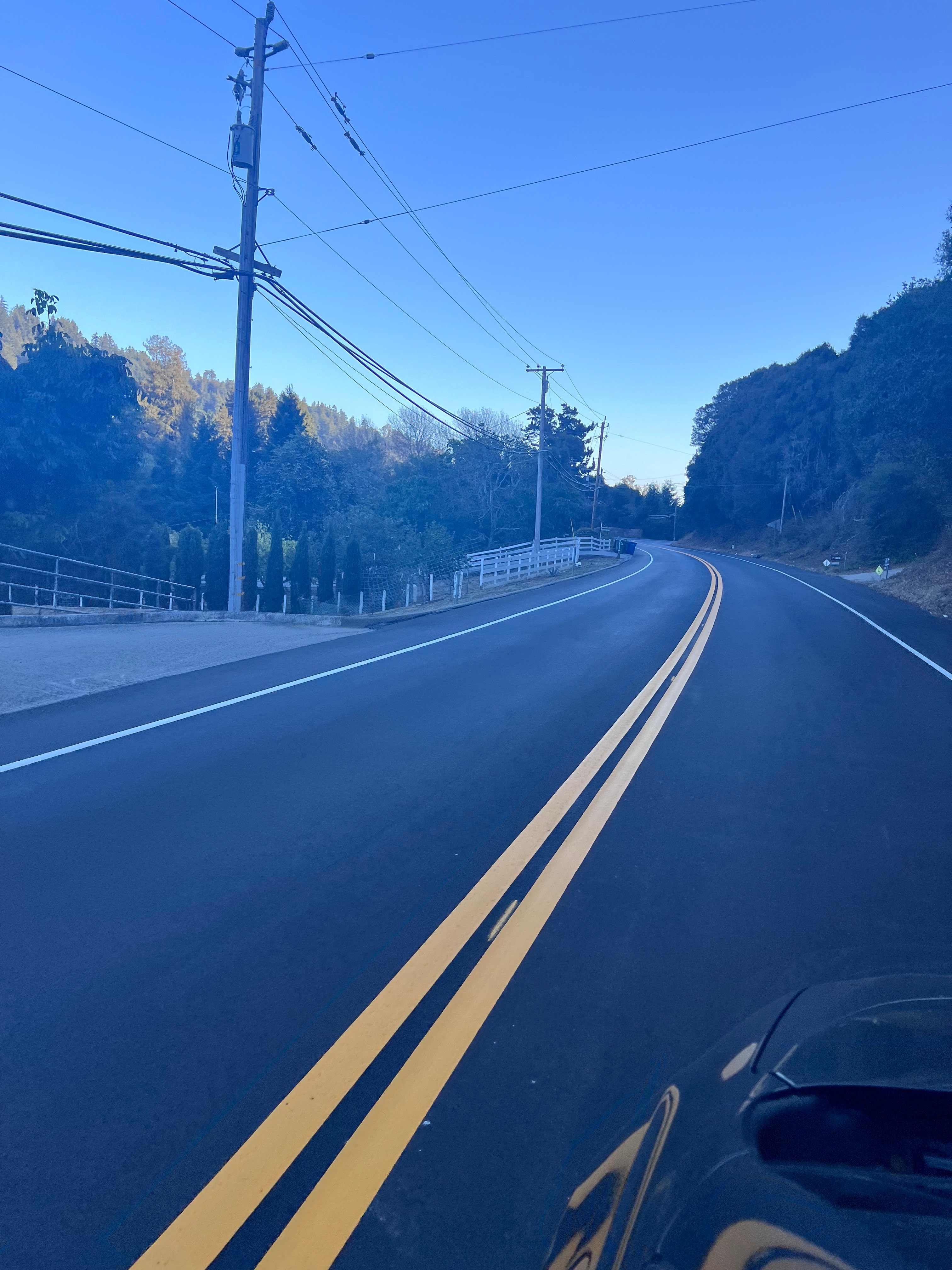
Old San Jose Road—with no traffic—following the recent repaving project, September 2026.
Old San Jose Road: What Happens When Everyone Needs to Leave?
Anyone who lives along Old San Jose Road knows what afternoon traffic can look like.
Recently, OSJ Road Firewise member Rich found himself sitting in that traffic and started wondering about the history of the road. What began as a little curiosity led him down a local-history rabbit hole—and eventually to a much more serious question about the road we all depend on.
A Road With a Long History
Rich discovered that Old San Jose Road has been carrying people through this area for generations—and that it was once part of a toll route over the Santa Cruz Mountains.
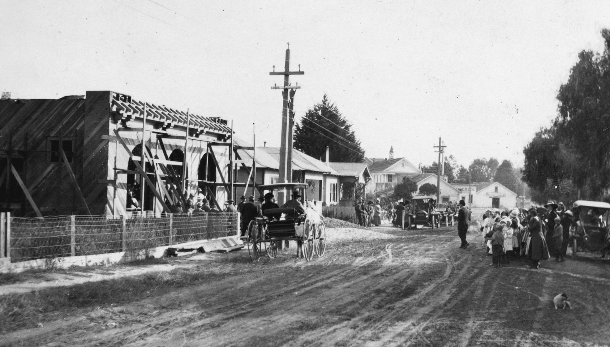
Community Event During the Construction of the Soquel Library, 1912. Courtesy of the Soquel Pioneers and Historical Association — SoquelPioneers.com
This photograph from 1912 gives us a glimpse of Old San Jose Road more than a century ago, when horses and early automobiles were sharing local roads.
Long before Highway 17, the route between Soquel and the Santa Clara Valley was known at different times as the Soquel Turnpike, Soquel and San Jose Road, and Old San Jose Road. Travelers heading over the mountains even paid a toll.
Historical rates included 25 cents for a horse and rider, 37½ cents for a horse and buggy, and 50 cents for a wagon and team of horses.
Rich jokingly wondered whether bringing back the toll might help with today’s afternoon traffic.
But that led to a much more serious question:
What happens if everyone on Old San Jose Road needs to leave at the same time?
That question couldn’t have been more timely.
Can We Evacuate Safely?
On September 9, County Supervisor Manu Koenig presented “State of Santa Cruz County Roads: Evacuation Routes,” a community Zoom presentation looking at evacuation safety, the condition and capacity of county roads, and what happens when large numbers of people need to leave at once.
He organized the discussion around three basic questions:
Can we evacuate safely?
Will our roads be passable?
What can we do now?
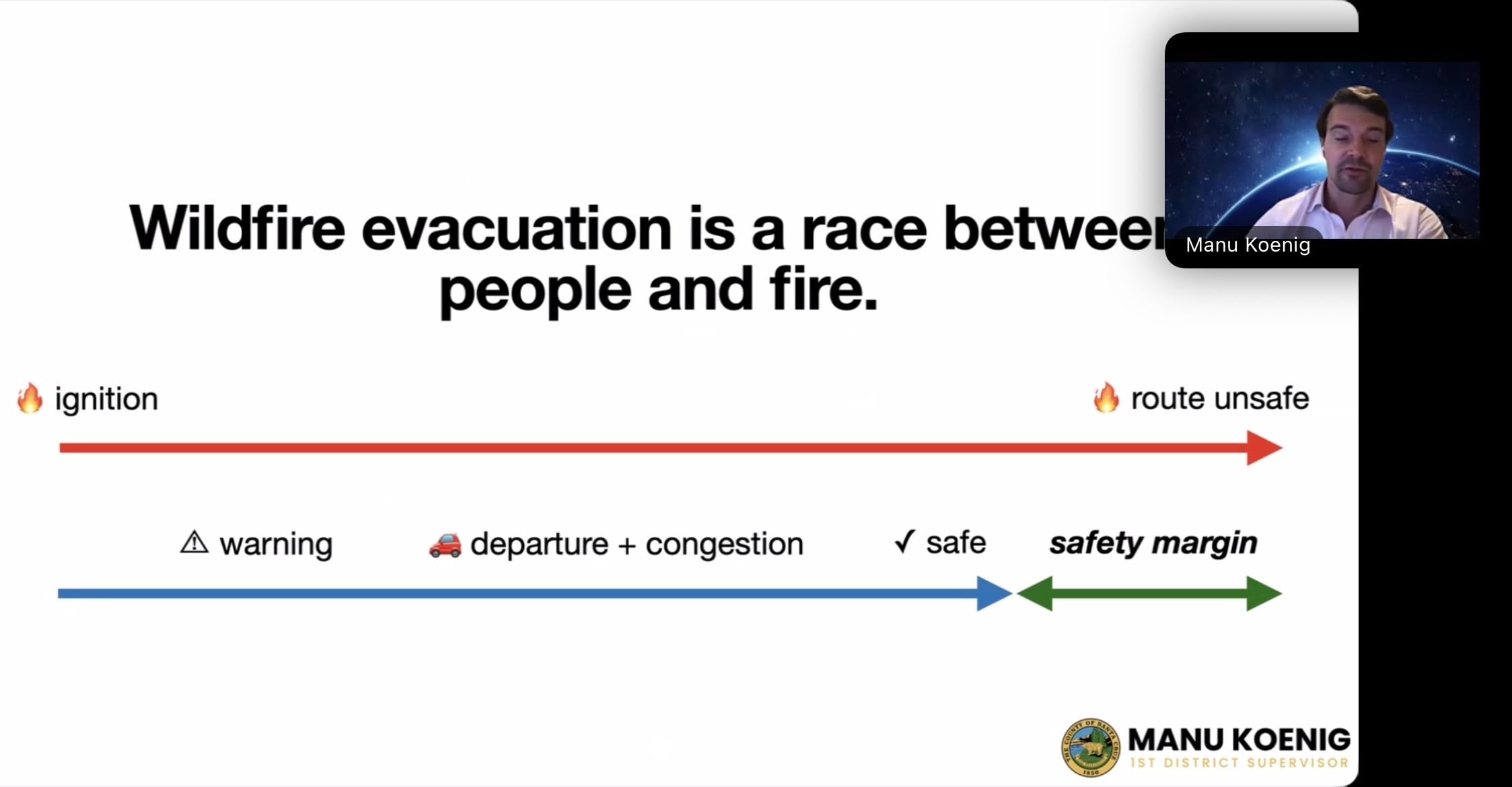
One of the simplest ideas from the presentation was also one of the most striking:
“Wildfire evacuation is a race between people and fire.”
Having an evacuation route on a map isn’t enough. There is a limited amount of time between a fire starting and the point when a road may become unsafe.
Within that window, residents have to receive a warning, prepare to leave, get onto the road, move through congestion, and reach safety.
For those of us who can already see significant congestion on Old San Jose Road during an ordinary afternoon commute, that’s a particularly important question.
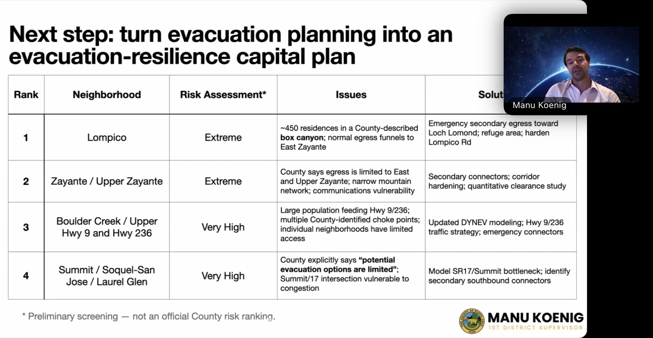
Our Area Was Specifically Identified
In a preliminary screening, Summit / Soquel-San Jose / Laurel Glen was identified as an area of “Very High” concern, with potential evacuation gridlock and congestion at the Highway 17/Summit intersection.
Roads Are Emergency Infrastructure
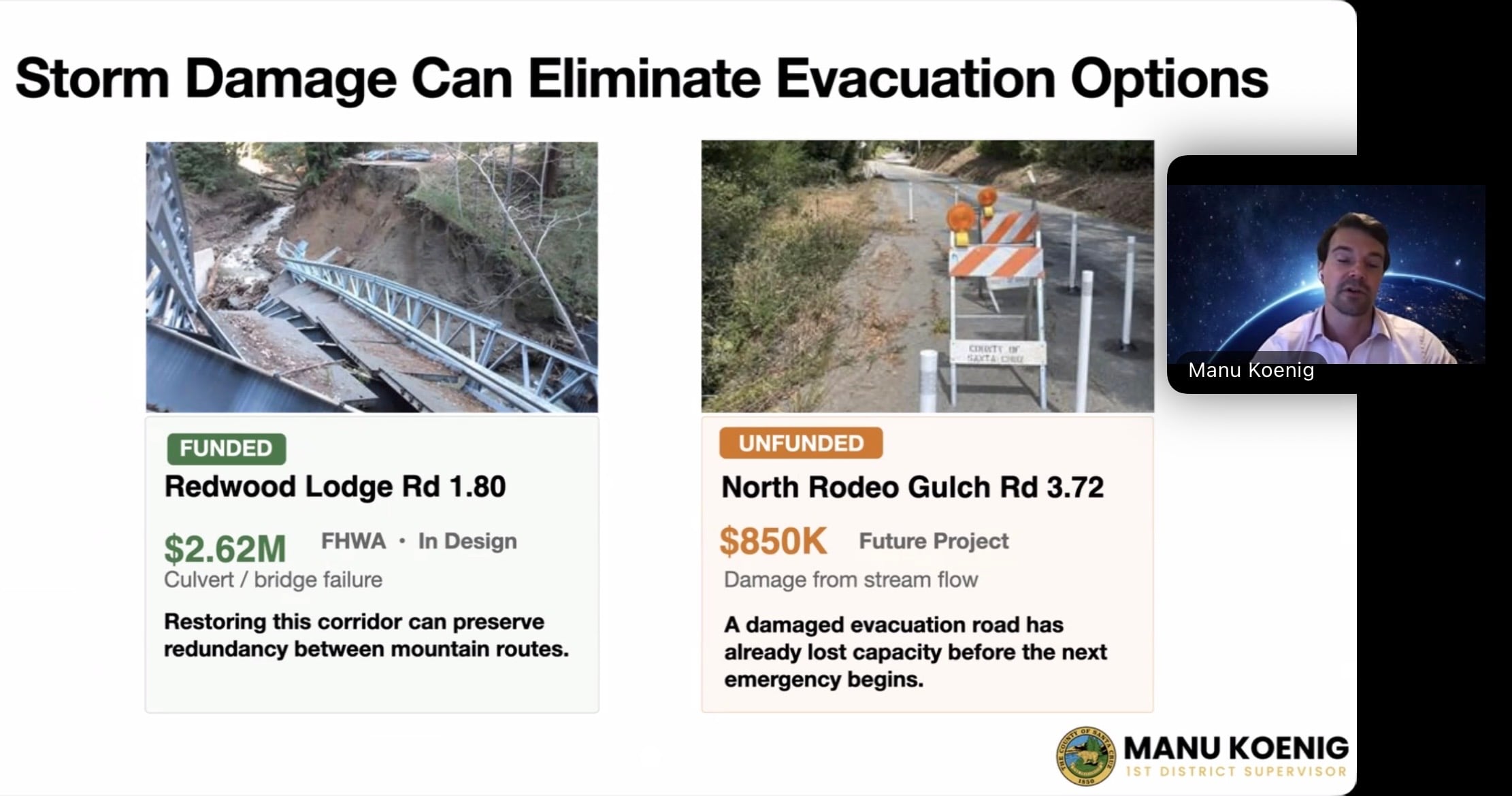
The presentation also looked at the condition of the roads themselves. Koenig showed examples of nearby road projects (including North Rodeo Gulch and Redwood Lodge roads) and a countywide picture of failing and poor-condition culverts.
The point is important for wildfire evacuation as well as winter storms: when a road is damaged or impassable, we’ve already lost an evacuation option before the next emergency begins.
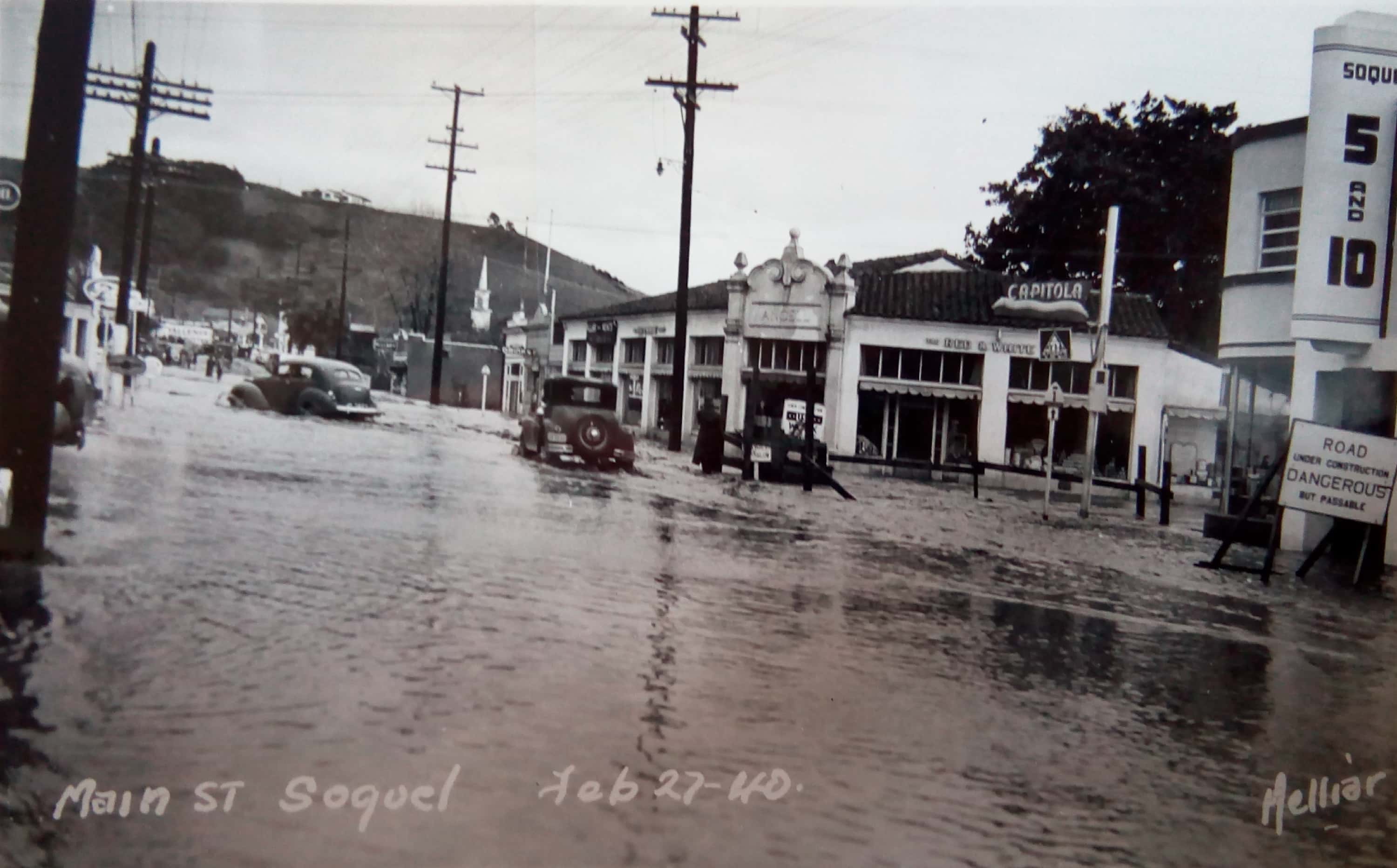
Postcard showing the 1940 flood on Main Street in downtown Soquel, February 27, 1940. Courtesy of the Soquel Pioneers and Historical Association — SoquelPioneers.com.
Our local history is full of reminders that roads we depend on can become impassable.
Koenig’s presentation brought that concern into the present: when a road or culvert fails, we may lose an evacuation option before the next emergency even begins.
What Can We Do?
Koenig ended the presentation by asking what it would take to move from evacuation planning to an “evacuation-resilience capital plan” which is one that actually prioritizes the road projects that could help people get out safely.
That’s where the presentation shifted from County planning to community action.
Koenig introduced the proposed Safe and Resilient County Roads Act, which would require the County to dedicate at least 10% of its unrestricted General Fund revenues to road infrastructure until specified safety and road-condition goals are met—including evacuation safety, storm-damaged roads, failing culverts, and pavement conditions. It would not create a new tax; it would change how a portion of existing County revenues is prioritized.
But getting that level of funding committed to roads will require more than one supervisor proposing it. The effort now has to be community-led: residents must organize, gather the required signatures to qualify the measure for the ballot, and ultimately persuade voters to pass it.
Members of neighboring Rodeo Gulch Firewise are among those helping organize that countywide effort. OSJ Road Firewise is sharing the information because road conditions, emergency access, and whether our community can evacuate safely directly affect all of us.
Residents who want to help can attend a Board of Supervisors meeting, collect signatures, volunteer, or donate.
Back to Old San Jose Road
More than a century ago, people were already traveling this route between Soquel and the mountains. The road has changed enormously since that 1912 photograph—horse-drawn wagons gave way to cars, the old toll road gave way to the road we know today, and Highway 17 changed how people travel over the mountains.
But Old San Jose Road is still a critical connection for the people who live along it.
That’s what makes Rich’s afternoon traffic question worth coming back to. If this road can become congested during an ordinary commute, what happens when an entire community needs to leave during an emergency?
Koenig’s presentation makes clear that answering that question isn’t just about having an evacuation route on a map. It’s also about maintaining the roads, bridges and culverts we already have, understanding where congestion could occur, and identifying alternate connections before we need them.
Our newly paved Old San Jose Road may look great right now—but the bigger question is whether the network of roads around it is ready when we need it most.